//ads start// //ads end// ಸುತ್ತೋಣ ಬನ್ನಿ - Sutthona Banni: KODAGU

///ad links google adsence


 Chelavara Falls is one of the most beautiful falls in Coorg, which is located around 40 km away from Madikeri and 20 kms from Virajpet. Chelavara Falls is also called as Embepare by the locals meaning Tortoise Rock.

The water fall is really a wonder full view as the water gushes from the top amidst the green coffee plantation.

This fall is popularly known as the Embepare, which means Tortoise Rock in the colloquial language. From the waterfall, visitors can view the water gushing through the green coffee plantation. Tourists visiting Chelavara Falls can also visit Choma Kund hill, which is just 2 km away from the falls.

Photo Gallery:


Photos: Shriharsha BS, Nitin, Vikas, Pradeep S, Bharath, Madan - Sutthona Banni Team Karnataka
Information Courtesy: Wikipedia

 Nalknad Palace (Kannada: ನಾಲ್ಕು ನಾಡ್ ಅರಮನೆ) is a palace located in the Kodagu district of the Indian state of Karnataka.

 It is situated the foothill of Tadiyandamol, the highest peak of Kodagu (near Kakkabe village). It is a two storeyed building, supposed to be the summer palace of the Kodava kings. It is located near a village named Yavakapadi and was built between the years 1792 and 1794 AD. This palace was the last refuge of the last king of Kodagu, Chikka Veerarajendra before he was deposed by the British. The Kannada film Shanti, which has only a single actor, was shot in the surroundings of the palace.
History:
After the death of the Kodagu king, Lingaraja I in 1780 AD, Hyder Ali captured Kodagu under the pretext of being a guardian to Lingaraja's sons, Dodda Veerarajendra and Linga Rajendra who were of tender age. The princes were sent to reside in a fort at Gorur in Hassan district, a garrison was stationed at Mercara (capital of Kodagu) and a minister (Amaldar) was appointed to look after the administration of Kodagu. The people of Kodagu were angry at the takeover of Kodagu by Hyder Ali and rebelled against him in 1782 AD. Since Hyder Ali was busy in fighting against the British army, they managed to throw the garrison out of Kodagu and proclaim their independence.

After Hyder Ali's death, his son Tipu Sultan wanted to recapture Kodagu. He moved the Kodagu princes from Gorur to Periyapatna and closely monitored them. However, Dooda Veerarajendra managed to escape and returned to Kodagu. He started to wage battles against Tipu Sultan's army which forced Tipu to send a large force to Kodagu to subdue the king. Tipu Sultan's army was able to capture some forts but suffered heavy losses as well. However, Dodda Veerarajendra managed to recapture the forts except the Mercara fort. He decided to move to a thickly forested area called Nalknad and convert it as a base for its operations. He built the Nalknad Palace here. It was a two-storeyed structure with a tiled roof. Since Dodda Veerarajendra did not have any sons from his first marriage, he married Mahadevammaji in 1796, and this marriage took place in Nalknad Palace. However, his second queen also could not bear him any sons. After Tipu's death, he entered into an alliance with the British to maintain peace with them.

When Dodda Veerarajendra died in 1809, his ten-year old daughter Devammaji was declared as the "queen of Kodagu". However, in 1811, Linga Rajendra, the younger brother of the deceased king, proclaimed himself as the king of Kodagu and ruled the region till his death in 1820. Chikka Veerarajendra, the son of Linga Rajendra, became the king of Kodagu. In 1832, differences began to rise between the king and the British, forcing the king to start a war against the British. However, the Britishers attacked Kodagu with full force and began to make inroads. Chikka Veerarajendra moved to Nalknad Palace which became his last refuge. In order to prevent major losses, the king had to surrender and the British deposed him to Benares. With this, Kodagu came under the direct rule of the British and Chikka Veerarajendra remained as the last king of Kodagu.
 Route Map:
 From Madikeri: Madikeri--> Napoklu --> Kakkabe --> Palace bus stop --> Nalknad Palace
 From Virajpete: Take the road to Kakkabe from Virajpet. Pass through the villages of Karada, Kadanga, Cheyyendane and reach Palace stop. Take a turn here and travel for three km to reach Nalknad Palace.
Protection and renovation:
The palace is a protected monument under the aegis of the Directorate of Archaeology and Museums, Government of Karnataka. It was renovated by INTACH. There is a proposal to make the palace into a major tourist spot by converting a part of it as a museum to display the crafts of the Kodagu region. A sum of Rs. 2.29 million was spent on renovating the palace.

Photo Gallery:


Courtesy: Wikipedia


Chiklihole reservoir in Kodagu District  (Coorg) is located in between Madikeri and Kushalnagar and is roughly around 5 kms from Dubare, 15 kms from Kushalnagar and 45 kms from Madikeri.The best time to visit would be during monsoon and winter i.e from June to March as there will be more water in the dam. The best part at Chicklihole is the sunset. This place is very beautiful picnic spot. 


Chikli hole is one of the small reservoirs on the Cauvery stream.The overflow of water on the semi-circular structure of Chiklihole reservoir, which has no crest gates, attracts tourists.

Photo Gallery:


  Photos & Information: Shriharsha BS, Nitin, Pradeep S, Madan, Vikas, Bharath - Sutthona Banni Team Karnataka


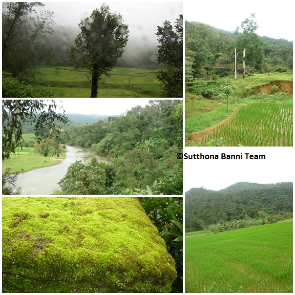
I  and my friends from the VVIET college went to MugiluPete, Pushpagiri wildlife sanctuary and Dubare  which are near to Madikeri.

Mugilupete(Mandalapatti):

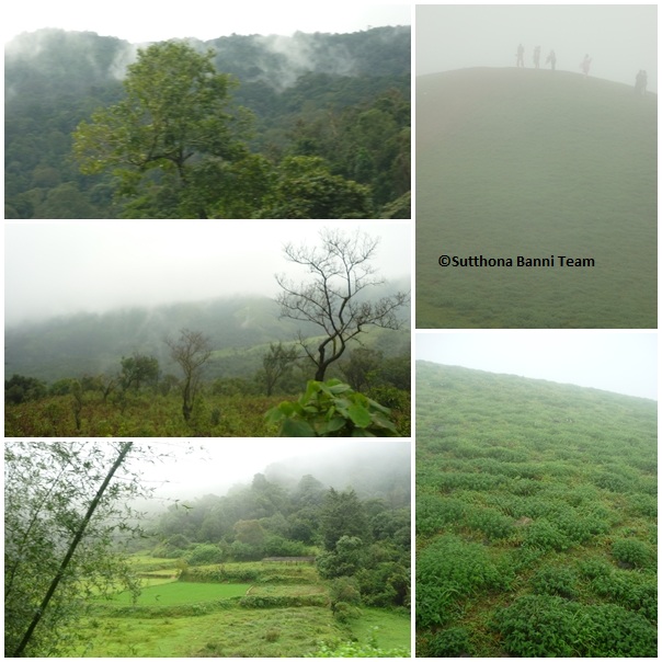
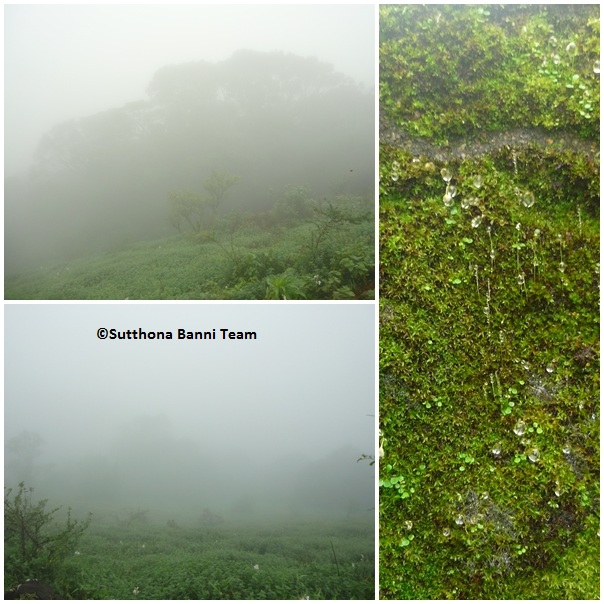
MugiluPete (Mugilpete) is around 20-30kms from Madikeri. This place is popularly known as Mandalpatti. It is called as "Mugilupete" due to Kannada film "Galipata". MugiluPete is very cold & almost all the place is covered by mist.

This place comes near to Somwarpete town. Mandala Patti is one of the trekking points in Pushpagiri Wildlife Sanctuary or Pushpagiri Forest Range. Pushpagiri Forest Range spreads from Subrahmanya in Dakshina Kannada district to Somwarpet in Coorg district covering an area of 102.6 sq km. Kumara Parvata Peak stands the tallest amongst the peaks in Pushpagiri Wildlife Sanctuary.

The route is adventurous, with steep curves and zigzag tracks, and Abbi Falls lies along the way. As the roads leading to MandalPatti are narrow, ones who have decided to make it to the beautiful spot need to be a bit adventurous too. But the adventure is worth for the way to the spot is dotted with nature’s bounty as one passes through viewing lush green coffee estates, paddy fields and mountains.


There is an entrance fees (Rs.40 per head/now it is increased to 200) near the view-point (mantapa). If you feel it costly, you can climb any of the adjacent small hills to have an equivalent view. You can camp in this place with the prior permission.

Famous Kannada movie “Galipata” has been shot here. In that film they have shown this place as Mugilu Pete. So after that Mandalpatti became famous as Mugilupete. Only 1 song “Nadhim Ta Na” and last seen of Galipata has been shot here. Many other Kannada films like "Modala Sala", "Raj" has been shot here.


You can watch the video about Mandalpatti in youtube.
Youtube TV-9 video link: http://www.youtube.com/watch?v=vud2GASOTlM

There is no food facility in Mugilupete.
Accommodation: Madikeri
Best time to visit is 
September to January (The right time to reach the spot is 12.00 noon and it is better to be back by 4.00 pm.)
Nearest City: Madikeri, Somwarpet
Air: Closest Airport: Bangalore (260 km), Mangalore (135 km)
Rail: Closest Railway Station: Mysore (146 km)
Road: Bangalore - Channapatna - Mandya - Mysore - Kushalnagar - Madikeri - From here the sanctuary is 25 Kms
You can join the "Mugilupete VVIET" community in orkut.


Route map to Mandalapatti( Mugilupete):

In Mysore-Madikeri state highway you have to take deviation towards "Abby Falls". Then 3kms before Abby Falls you get a y junction where left turn leads to Abby falls and the right mud road will lead you to the Mandalapatti.You have to take right deviation towards Mandalapatti .This road is very bad & it is difficult to go in bike or car. It is better to go in SUV(4wd)s. You can hire jeep from Madikeri which costs around 900 rupees.
Bengaluru ---> Mysore ---> Madikeri ---> Towards abbi falls --->Right in Y junction --->  Mandalapatti(Mugilupete)

Photo Gallery:


 Road to Mugilu Pete
                                                                            MugiluPete


Mantapa in Mugilu pete

MugiluPete

Pushpagiri Wildlife Sanctuary

Dubare


Suhas Kashyap

Photos: Suhas Kashyap- Mysore
Information: Sagar.R, Suhas Kashyap-Mysore(Sutthona Banni Team Mysore)


Mallali falls in Kodagu, in the Western Ghats in Karnataka, Mallalli falls is situated in the foots of pushpagiri hills. Mallalli Falls is situated in Coorg and is around 25 km from Somwarpet and 265 km from Bangalore. The exact location of Mallali falls is in Bettadahalli Gram Panchayat in Somwarpet of Coorg. It's is an eye feasting sight of river Kumaradhara gushing through the valley and falling into a gorge, with lush green mountains around.

At Mallalli Falls lies in the footsteps of Pushpagiri Hill Ranges, where Kumaradhara river fall over 200 ft. creating a spectacular sight. Here the water falls into a gorge surrounded by steep, lush green mountains, which can be accessed by many a winding a path; providing an apt location for trekking.

Photo Gallery:


Photos: Amritraj Nayak- Mangalore
Information Courtesy: Wikipedia


Pushpagiri Wildlife Sanctuary is one of 21 Wildlife Sanctuaries of India's Karnataka state.

This sanctuary is located in Somwarpet taluk,20 km from Somwarpet town northern part of Kodagu district.and has some attractive scenery. It is home to rare and endangered birdlife and is designated as one of the important bird areas of the world. The rich Kadamakkal reserve forest is a part of the sanctuary. Pushpagiri is the highest peak in it. Kumaraparvat (Kumaraparvatha) is the other peak that lies within it. The sanctuary adjoins Bisle reserve forest to north and Kukke Subramanya forest range to the west.

Pushpagiri, at 1,712 meters, is the highest peak in Pushpagiri Wildlife Sanctuary in the Western Ghats of Karnataka

Pushpagiri Mountains

The Pushpagiri (aka Subramanya Hills) lies at an imposing altitude of 5,626 ft and is 2nd highest pride of Kodagu.
About 36 km from Somwarpet and 1.5 km from Kumaralli, it is located amid the jungle. Trekking can be done from the base, Bhagati, which is a 10 km, three-hour walk. Otherwise, trekkers can cross Subramanya, located in Dakshina Kannada district of Pushpagiri Range. The trekking zone can be approached from Pushpagiri or from Kumaraparvat peaks.
Eastern entrance can be obtained from Beedehalli via Heggademane temple and Western entrance from Kukke Subramanya via Giri gadde. However, the entrance through Beedehalli—tiny hill hock boondock— is less strenuous, comparatively.
The entrance from Kukke Subramanya is located the sea level.

Time to visit

  • Best: October to January (when the soil is dry)
  • Worst: June to September (soil is wet due to rain, have to encounter lot of leeches)

Permissions required to be taken for trekking

Need to pay Rs 200 towards forest entry fee to the forest guards.


Flora and fauna

Albizia lebbeck, Artocarpus lakoocha, Dysoxylum malabaricum and Mesua ferrea' are some of the species of flora found here. Indian Wild Dog, Brown Palm Civet, Indian Giant Squirrel, Indian Hare, Spotted Deer, Sambar, Indian Muntjac, Gaur, Asian Elephant, Wild Pig, Giant Flying Squirrel, Travancore Flying, Otter species, Stripe-necked mongoose and mouse deer are some of the animal species found here.
The Pushpagiri Wildlife Sancutuary has been proposed as a World Heritage Site.
Photo Gallery:


Photos: Amritraj Nayak- Mangalore
Information Courtesy: Wikipedia