//ads start// //ads end// ಸುತ್ತೋಣ ಬನ್ನಿ - Sutthona Banni: SHIVAMOGGA

///ad links google adsence


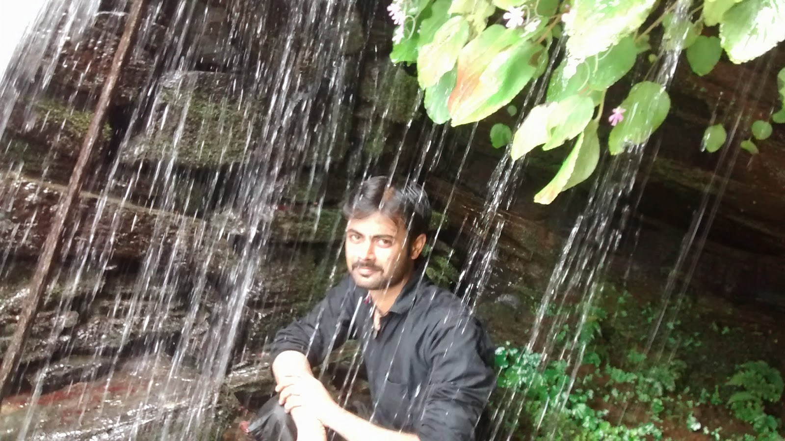
Dabbe falls is one of the must visit places in Shimoga (Shivamogga) district which offers tourists a great pleasure of nature. Dabbe Falls is located near Hosagadde in Sagar taluk. On the road from Sagar to Bhatkal (Kogar Ghat), Hosagadde lies about 20 km from the town of Kargal (Near to Jog Falls). From Hosagadde a walk of 6–8 km into the forest leads to Dabbe Falls.

 The trek route through the deep valley leads to the delightful Dabbe Falls. Trekking to Dabbe falls is very risk as the last 1.5 km trekking is downwards almost 80 degree with no proper stairs. One has to trek using branches and roots of trees and rocks. Last 1.5 km of trekking which consumes lots of time.

Nearby Tourist Places: 

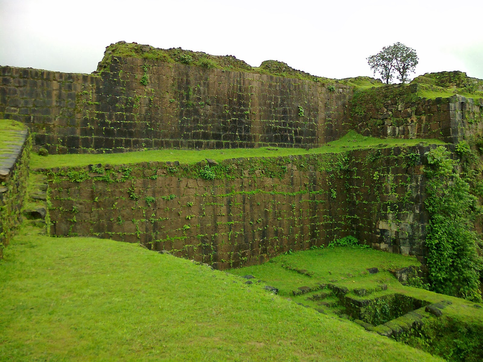
Kanoor Fort, Bhima-Lingeshwara Temple, Sharavathi wildlife Sanctuary, Jog Falls

Route Map:

From Kargal Town--> Go in SAGAR-BHATKAL state highway  towards Bhatkal  up-to Hosagadde  -->   Take Right deviation & go in mud road which is going towards Dabbe Mane up-to 6km (approx)  -->  Then trek for 1.5 km, you will get Dabbe Falls.

Take the help from local people to reach Dabbe falls.

Transport: 

There is no bus till Dabbe falls. KSRTC buses has stop at the main road which is 8 km. Four wheeler can reach 4 more kilometres inside and bike can go up-to 6km. Then you have to trek for 1.5 km to reach till Dabbe falls. 
Note: There is no food facility nearby Dabbe falls, so carry water bottles & food.

Photo Gallery:  


Photos & Information Courtesy: Gajanan Bhat- Magegar


“Shivappa Nayaka Fort” is located in “Nagara” town ,“Hosanagara” Taluk, Shivamogga District. Nagara is at distance of 19 km from Hosanagar. Nagara was the last capital of the Keladi kings.  Nagara earlier known as Bidanur Kingdom of Shivappa Naik has a fort dating back to early 17th Century. It is in the interior Malenadu region with scenic natural beauty. During monsoon it is surrounded all round by the backwaters of Linganamakki reservoir. The fort being upkept by the Archeological Dept. is worth visiting. Kollur is 48 Km from this place.Few attractions of Nagara are Shivappanaika palace, fort, Devagana tank, Neelakenteshwara temple and Gudde Venkataramana Swamy temple.

Shivappa Nayaka(Kannada:ಶಿವಪ್ಪ ನಾಯಕ) (reigned 1645–1660), popularly known as Keladi Shivappa Nayaka, was a notable ruler of the Keladi Nayaka Kingdom. The Keladi Nayakas were successors of the Vijayanagara Empire in the coastal and Malnad (hill) districts of Karnataka, India, in the late 16th century. At their peak, the Nayakas built a niche kingdom comprising the coastal, hill and some interior districts (Bayaluseeme) of modern Karnataka, before succumbing to the Kingdom of Mysore ruled by Hyder Ali in 1763. He was known as Sistina Shivappa Nayaka because he introduced a tax system called Sist.

Photo Gallery: 


Photos & Information: Shyamsundar Hegde-Magegar

  
Balebare Falls (Baalebare Falls) is located in Balaebare Ghat. Balebare ghat is a ghat road between Siddapur in Udupi district and Mastikatte in Shimoga district (SH-52). This place receives heaviest rainfalls during monsoon turning every corner and gap into a waterfall.

Balebare Falls is located nearly 6 km from Mastikatte. From Mastikatte you have to go in SH-52 (Teerthahalli-Kundapur State Highway) nearly 6 km at right side you can see the waterfalls. But this falls is visible in monsoon season only.

The Varahi, Savehaklu and Chakra dam, Kavaledurga are the must visit places

Photo Gallery:


Photos & Information: Sudeep N (KPCL)-Mastikatte (Sutthona Banni Team)

 Mani dam (also called as Maani Dam or Varahi Dam) is a hydroelectric dam, (as it is constructed near Manibail village), across the Varahi river. Power generation takes place underground. An underground power station built by KPCLuses water from this river near Hosangadi in Udupi district. The dam is near Yadur near Masthikatte, Shimoga District. Many are villages were surrounded by water due to this dam. To go to this dam you have to take special permission from KPCL because this is a restricted place for tourists.

Photo Gallery:
 

Photos & Information: Sudeep N(KPCL)-Mastikatte (Sutthona Banni Team)

 Kunchikal Falls (Kannada: ಕುಂಚಿಕಲ್‌ ಜಲಪಾತ), also called Kunchikal Abbe, are located near Masthikatte-Hulikal in Shimoga district of state of Karnataka. Kunchikal falls are formed by Varahi river. Varahi River cascades down hundreds of rocks near Hulikal (Ghati Temple), Hosanagara taluk, Shimoga District.

Height

Kunchikal falls cascades down rocky boulders and total height of this fall is 455 meters (1,493 feet) and this height makes this falls as highest waterfalls of India. The total length of cascade exceeds 1 km.

Waterflow


After construction of Mani Dam near Masthikatte and underground power generation station near Hulikal, Shimoga district, the water flow to this falls is greatly reduced and visible only during rainy season (July-Sept).

Photo Gallery:
Kunchikal Falls view from Metkalgudda 
Photos: Manjappa Jois-Hosangadi
Information Courtesy: Wikipedia

Jogi gundi falls is near to  Agumbe, Shivamogga District. It is not known for its height because height is well within 20 feet. But it is known for its natural beauty around it.

To reach Jogi Gundi falls from Agumbe, go some 100m in the Agumbe - Sringeri highway and then take a right turn. There is a road though not good for about 3 km and then you have to take right turn again. From here no vehicles can go. If you love trekking, you can walk from Agumbe bus stand to here. The walking distance is around 5 km and if you are in groups, it will be fantastic because the path is so beautiful and you will enjoy this journey fully. You have to walk from here for about 600m to reach the falls
.

There is a large pool and the water is falling down from one side of the rock mountain. The pool is very beautiful and equally dangerous. If you take some villagers with you, they will tell some strange stories about this place. After going out of the pool, the water is flowing in a zigzag manner through rocky path and there you can play, bath, and enjoy the fresh water.

Courtesy: Wikipedia

The Barkana Falls (Kannada: ಬರ್ಕಣ ಜಲಪಾತ) is among the ten highest waterfalls in India. This falls is located near Agumbe in Shimoga district of state of Karnataka. The Barkana falls are formed by the Sita river. Currently Barkana falls is the prime source of one of the hydro electric projects in Karnataka. It is a wonderful location for sightseeing and enjoying a picnic, but beware of the leeches during the rainy season.

Courtesy: Wikipedia

Onake Abbi Falls is a beautiful waterfall located near Agumbe at a distance 30kms from Thirthahalli. The first part of the name 'Onake' is a Kannada word that refers a large and thick stick which is used in making powders from food grains. The falls got the name because there is only one branch in the falls and it is like 'onake'!.  The falls is around 450-500 feet high. This is also a great trekking destination from Agumbe bus stand to falls (6 km).

Route Map:

Route 1:

There are two ways to reach here. One is while coming from Agumbe bus stand towards Agumbe check point, you will see in the right side a small arch written as”'Oushadeeya  Sasya Vana”. Just start in that road from the arch and that is the single road that will take you to the falls (No turns).

Route 2:

Another one is from the Agumbe check point. There is a small lake and adjacent to that there is a small park. If you go to the right end of the park, you will see the board as “Onake Abbi Jalapathakke Charana Hadi” in Kannada. From here if you start, you will join the 1st suggested path in the mid way. There is no clear path here, you have to find the traces of used path and follow the same. If you are new to forests and trekking, then this path is not for you!. You have to walk around 1 km to join the clear mud road. You have to walk around 4 km in the mud road. Around 200 mt before the falls, there are steps to go down a little because the place is pretty much in 'V' shape. From that distance itself, you can hear the roaring sound of this amazingly beautiful falls. Once you clear the steps, you will see the 'Onake Abbi Falls'. Beware of “Leaches”.


Don't forget to take some food with you because you feel extremely hungry here and if you have no food then you have nothing to eat here. Near the Agumbe check post, there is one 'Bajji - Bonda' shop.

Courtesy: Manjappa Jois-Hosangadi & Wikipedia

 The Chakra River is a river flowing through Kundapur and Gungulli in western India. It originates in Kodachdri peak. It joins with the Souparnika River, Varahi River and Kubja River and merges into the Arabian Sea.

The Chakra nagar is a small town which is famous because of this river.Chakranagar is on the way to Shimoga to Mangalore via Hosanagara Nagara- Mastikatte- Chakranagar-Kundapuar.There is also a Chakra dam which was built long ago as a balancing reservoir and does not have sluice gate to the Linganamakki Dam and you need special permission to visit this dam.The Chakra Dam was a KPC project and the chief engineer was B Seetharam.

Getting There:

From Shivamogga go to Mastikatte (100km from Shivamogga).Masthikatte is a city located in Hosanagara Taluk, Shimoga district, Karnataka, India. From Mastikatte, Chakra Dam is about 20km. Savehaklu Dam is 10km. A guide & vehicle are required. For stay & food, Thirthahalli (45km) is the nearest place.

Nearest Places of Interest: Kunchikal Falls,Savehaklu Reservoir,Vanadurgeshwari temple,Varahi backwater, Chandikmba Temple-Hulikal. 

Photo Gallery:


Photos: Sudeep N(KPCL)-Mastikatte/Chitradurga (Sutthona Banni Team Karnataka)
Information Courtesy: Wikipedia

Sharavathi is a river which originates and flows entirely within the state of Karnataka in India. It is one of the few westward flowing rivers of India and a major part of the river basin lies in the Western Ghats. The famous Jog Falls are formed by this river. The river itself and the region around it are rich in biodiversity and are home to many rare species of flora and fauna.

Sharavathi Valley Wildlife Sanctuary

A part of the Sharavathi river basin was declared as a wildlife sanctuary on 20 April 1972. Spread over an area of 431.23 km2 (166 sq mi)., it has dense evergreen and semi-evergreen forests. Linganamakki reservoir spread over an area of 128.7 km2 (50 sq mi). is a part of this sanctuary. The remaining area has been divided into core zone (74.33 km².), buffer zone (170.67 km²) and tourism zone (57.53 km².). The altitude in the sanctuary varies from 94 to 1102 mts, the highest point being Devarakonda on the southern edge of the sanctuary. Temperatures range from 15° to 38 °C and mean annual rainfall is 4500 mm.
Flora
The sanctuary has mainly evergreen, semi-green and some moist deciduous forests. Trees in the evergreen forest include species such as Dipterocarpus indicus, Calophyllum tomentosum, Machilus macrantha, Caryota urens and Aporosa lindleyana. In the semi-evergreen and moist deciduous forests, common species include Lagerstroemia lanceolata, Hopea parviflora, Dalbergia latifolia, Dillenia pentagyna, Careya arborea, Emblica officinalis, Randia sp., Terminalia sp. and Vitex altissima.
Fauna
The sanctuary is a refuge of the endangered Lion-tailed macaque. Other mammals include tiger, leopard (black panther), wild dog, jackal, sloth bear, spotted deer, sambar, barking deer, mouse deer, wild pig, common langur, bonnet macaque, Malabar giant squirrel, giant flying squirrel, porcupine, otter and pangolin. Reptiles include king cobra, python, rat snake, crocodile and monitor lizard. Some of the avian species found in the sanctuary include three species of hornbill, paradise flycatcher, racket-tailed drongo, blue-throated barbet and Indian lories and lorikeets.

Photo Gallery:


Courtesy: Wikipedia

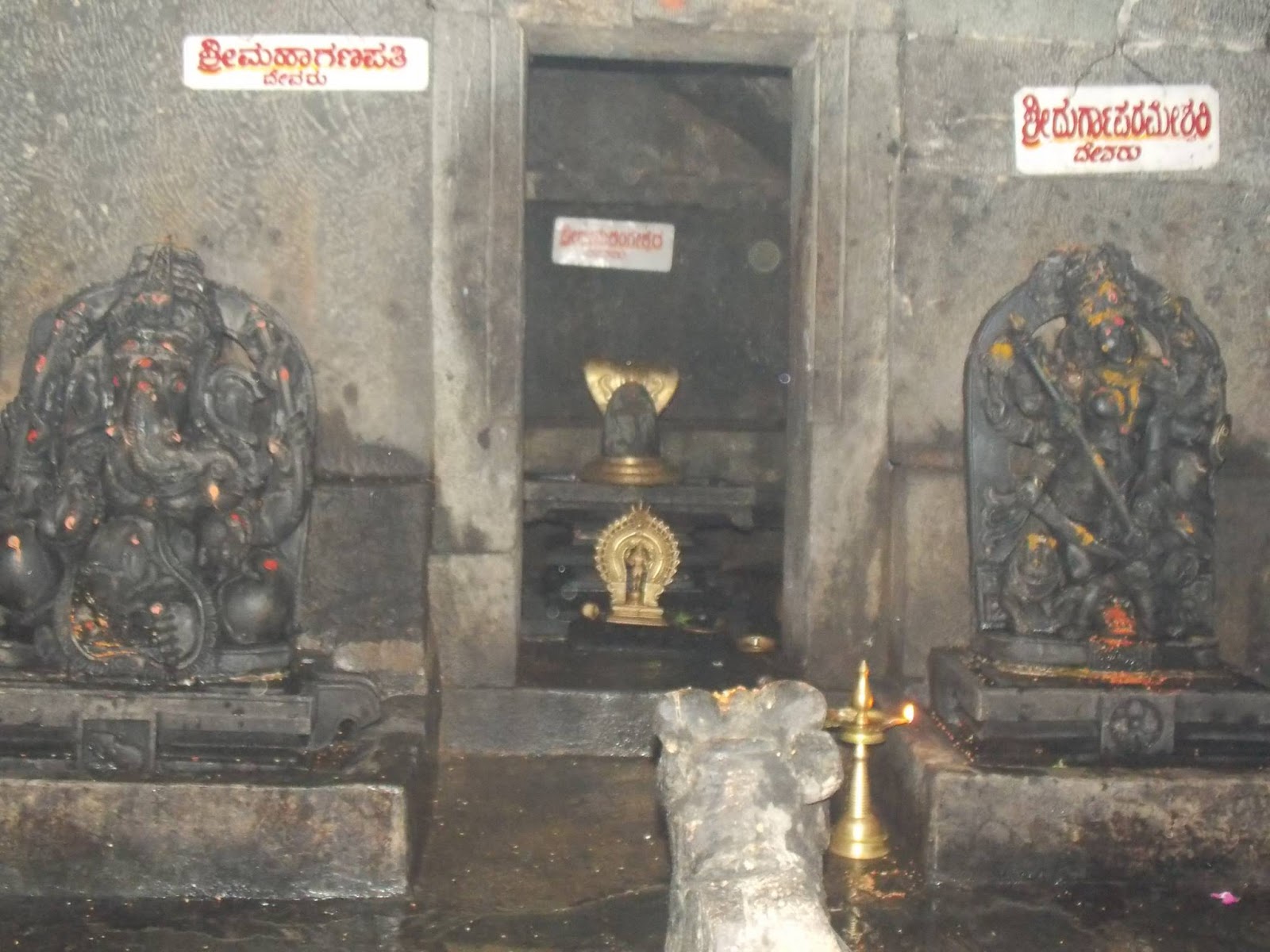
An ancient historical temple “Sri Bheemalingeshwara”  located in Bheemeshwara near Kargal town, which is in Shivamogga District of Karnataka state.  This temple is very beautiful. On the way to temple you can view the beauty of “Sharavathi Valley Wildlife Sanctuary”. This place is suitable for medium level trekking.


Route Map:

From Sirsi or Sagar town, go to Kargal.  Then go in “Kargal to Bhatkal” state highway nearly about 37km, then you will get “Bheemeshwar Bus Stop” (In Kogar Ghat). From that stop take right & go in mud road nearly 3 km which moves towards Bheemalingeshwara temple. The road is very steep & narrow and full  of ghat section. 

Nearby Tourist Attractions: 

 Dabbe Falls , Kaanuru Fort, Sharavathi Valley Wildlife Sanctuary, Jog falls


Photo Gallery:


Photos & Information: Shyamsundar Hegde, Gajanan Bhat - Magegar and Mahesh Hegde - Sirsi